
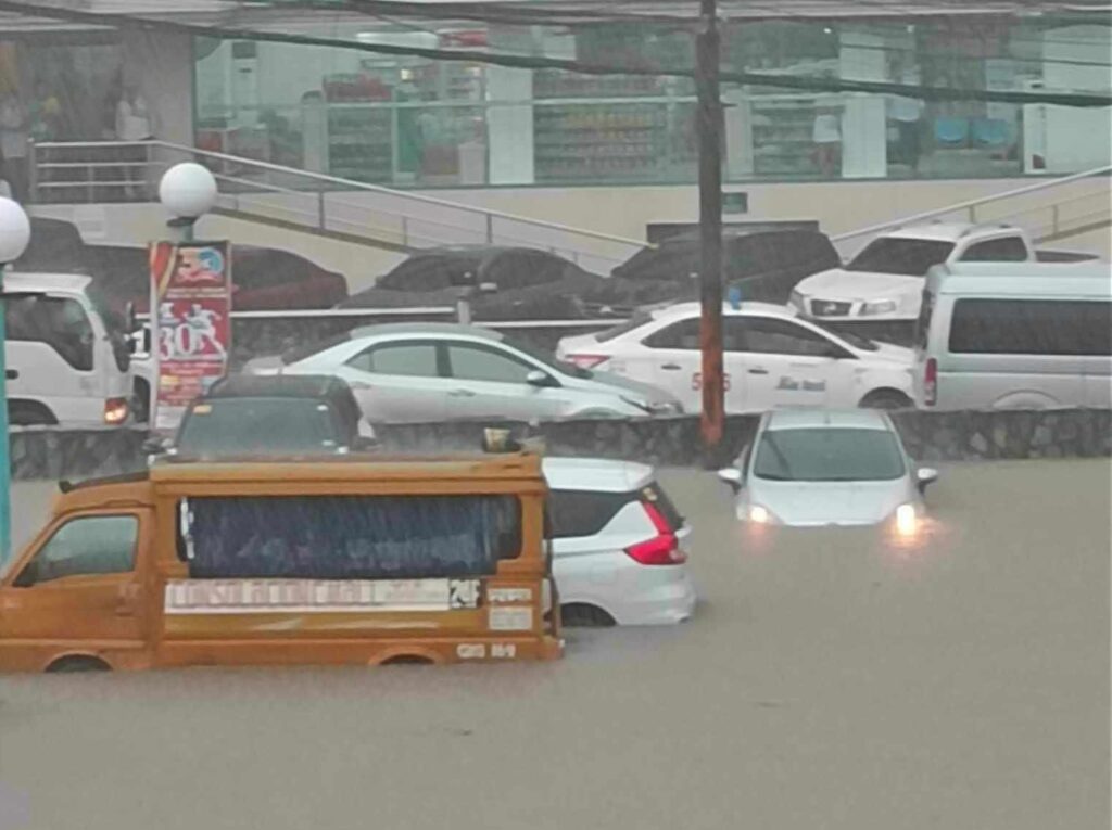
Some vehicles are half-submerged in flood waters in a parking lot of an establishment in Barangay Banilad, Cebu City, after the heavy rains this afternoon, September 11. | Contributed photo via Paul Lauro
CEBU CITY, Philippines – Expect cloudy skies and possible heavy rains in Cebu in the coming days, as a low pressure area (LPA) and the southwest monsoon or “habagat” continue to affect the Visayas and other parts of the country.
Engineer Al Quiblat, chief of the Philippine Atmospheric, Geophysical and Astronomical Services Administration (Pagasa) – Mactan Station, said that Cebu will experience mostly cloudy skies with a 60 percent chance of light to moderate rains, including occasional heavy downpours during severe thunderstorms, for at least five days starting today.
“These are the same weather conditions we’ve started seeing since Friday. Any time of day, but especially in the afternoon and evening, Cebu has high chances of experiencing rain and thunderstorms. This could be dangerous for flood- and landslide-prone areas,” Quiblat said in an interview.
READ: LPA may become tropical cyclone in next few days – Pagasa
Pagasa: LPA in PAR may become typhoon in 24 hours
Pagasa reported that the LPA was spotted 240 kilometers east of Virac, Catanduanes (13.7°N, 126.4°E) as of 3 a.m. Saturday. Although it has not yet intensified into a tropical cyclone, the agency said it has a medium chance of developing into one in the next few days.
Weather specialist Grace Castañeda of Pagasa’s central office explained that, even if the LPA strengthens into a storm, it is unlikely to make landfall in the Philippines.
However, its presence, along with the enhanced southwest monsoon, will result in widespread rains over Central and Southern Luzon, Visayas, and Mindanao.
“The LPA and habagat are working together to bring rains across many areas. For Cebu, this means cloudy conditions and scattered to widespread rainshowers,” Castañeda said in Pagasa’s 5 a.m. weather forecast.
Cebu 5-day weather outlook
For the five-day outlook in Cebu, Pagasa forecasts mostly cloudy skies with rainshowers and thunderstorms beginning Saturday, June 7, with temperatures ranging from 26 to 31 degrees Celsius. Winds will be light to moderate from the southwest, and coastal waters will remain slight to moderate.
Similar weather conditions are expected on Sunday, June 8, though temperatures may slightly dip to between 26 and 29 degrees Celsius. From Monday, June 9, to Tuesday, June 10, moderate winds and coastal conditions will persist, with temperatures hovering between 26 and 30 degrees Celsius.
By Wednesday, June 11, wind conditions are expected to strengthen, potentially making seas moderate to rough, while temperatures are forecast to remain within the same range.
Pagasa advised the public to remain alert, especially in low-lying and mountainous areas, due to the heightened risk of flash floods and landslides during heavy rains and thunderstorms. Coastal waters may also become hazardous starting midweek.
For real-time updates, residents are encouraged to follow Pagasa’s official weather bulletins and advisories. /csl